Maps showing Pool's Island, Bonavista North, Newfoundland and Labrador
Pool's Island is a Unincorporated area located in Bonavista North, Newfoundland and Labrador and has an elevation of 0 meters.
- Latitude: 49° 6' 44'' North (decimal: 49.1122222)
- Longitude: 53° 35' 3'' West (decimal: -53.5841666)
- Topography Feature Category: Unincorporated area
- Geographical Feature: Neighbourhood
- Canadian Province/Territory: Newfoundland and Labrador
- Elevation: 0 meters
- Location: Bonavista North
- Atlas of Canada Locator Map: Pool's Island
- GPS Coordinate Locator Map: Pool's Island Lat/Long
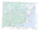
Pool's Island NTS Map Sheets