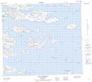
Maps showing Potuk Island, Newfoundland and Labrador
Potuk Island is a Island located in Newfoundland and Labrador and has an elevation of 10 meters.
- Latitude: 56° 22' 52'' North (decimal: 56.3812384)
- Longitude: 60° 59' 52'' West (decimal: -60.9977164)
- Topography Feature Category: Island
- Geographical Feature: Island
- Canadian Province/Territory: Newfoundland and Labrador
- Elevation: 10 meters
- Atlas of Canada Locator Map: Potuk Island
- GPS Coordinate Locator Map: Potuk Island Lat/Long
Potuk Island NTS Map Sheets