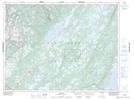
Maps showing Pratts Brook, Newfoundland and Labrador
Pratts Brook is a River located in Newfoundland and Labrador and has an elevation of 155 meters.
- Latitude: 49° 17' 5'' North (decimal: 49.2847222)
- Longitude: 57° 27' 14'' West (decimal: -57.4538888)
- Topography Feature Category: River
- Geographical Feature: Brook
- Canadian Province/Territory: Newfoundland and Labrador
- Elevation: 155 meters
- Atlas of Canada Locator Map: Pratts Brook
- GPS Coordinate Locator Map: Pratts Brook Lat/Long