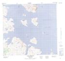
Maps showing Table Hill, Newfoundland and Labrador
Table Hill is a Mountain located in Newfoundland and Labrador and has an elevation of 684 meters.
- Latitude: 57° 43' 39'' North (decimal: 57.7273637)
- Longitude: 61° 41' 21'' West (decimal: -61.6892495)
- Topography Feature Category: Mountain
- Geographical Feature: Hill
- Canadian Province/Territory: Newfoundland and Labrador
- Elevation: 684 meters
- Atlas of Canada Locator Map: Table Hill
- GPS Coordinate Locator Map: Table Hill Lat/Long