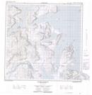
Maps showing Tellialuk Fiord, Newfoundland and Labrador
Tellialuk Fiord is a Bay located in Newfoundland and Labrador and has an elevation of 120 meters.
- Latitude: 59° 59' 52'' North (decimal: 59.9977482)
- Longitude: 64° 29' 35'' West (decimal: -64.4931860)
- Topography Feature Category: Bay
- Geographical Feature: Fiord
- Canadian Province/Territory: Newfoundland and Labrador
- Elevation: 120 meters
- Atlas of Canada Locator Map: Tellialuk Fiord
- GPS Coordinate Locator Map: Tellialuk Fiord Lat/Long
Tellialuk Fiord NTS Map Sheets