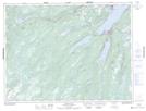
Maps showing Shoal Pond, Newfoundland and Labrador
Shoal Pond is a Lake located in Newfoundland and Labrador and has an elevation of 60 meters.
- Latitude: 49° 30' 41'' North (decimal: 49.5113888)
- Longitude: 56° 19' 21'' West (decimal: -56.3225000)
- Topography Feature Category: Lake
- Geographical Feature: Pond
- Canadian Province/Territory: Newfoundland and Labrador
- Elevation: 60 meters
- Atlas of Canada Locator Map: Shoal Pond
- GPS Coordinate Locator Map: Shoal Pond Lat/Long
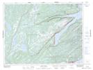
Shoal Pond NTS Map Sheets