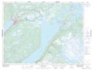
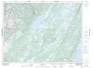
Maps showing Rocky Brook, Newfoundland and Labrador
Rocky Brook is a River located in Newfoundland and Labrador and has an elevation of 157 meters.
- Latitude: 49° 11' 47'' North (decimal: 49.1963888)
- Longitude: 57° 25' 54'' West (decimal: -57.4316666)
- Topography Feature Category: River
- Geographical Feature: Brook
- Canadian Province/Territory: Newfoundland and Labrador
- Elevation: 157 meters
- Atlas of Canada Locator Map: Rocky Brook
- GPS Coordinate Locator Map: Rocky Brook Lat/Long
Rocky Brook NTS Map Sheets