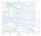
Maps showing The Turnpikes, Newfoundland and Labrador
The Turnpikes is a Island located in Newfoundland and Labrador and has an elevation of 1 meters.
- Latitude: 56° 36' 5'' North (decimal: 56.6013339)
- Longitude: 61° 37' 50'' West (decimal: -61.6305960)
- Topography Feature Category: Island
- Geographical Feature: Islands
- Canadian Province/Territory: Newfoundland and Labrador
- Elevation: 1 meters
- Atlas of Canada Locator Map: The Turnpikes
- GPS Coordinate Locator Map: The Turnpikes Lat/Long