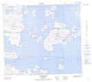
Maps showing Turtle Islet, Newfoundland and Labrador
Turtle Islet is a Island located in Newfoundland and Labrador and has an elevation of 0 meters.
- Latitude: 56° 30' 10'' North (decimal: 56.5026883)
- Longitude: 61° 7' 19'' West (decimal: -61.1218473)
- Topography Feature Category: Island
- Geographical Feature: Islet
- Canadian Province/Territory: Newfoundland and Labrador
- Elevation: 0 meters
- Atlas of Canada Locator Map: Turtle Islet
- GPS Coordinate Locator Map: Turtle Islet Lat/Long