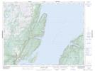
Maps showing Sops Island, Newfoundland and Labrador
Sops Island is a Unincorporated area located in Newfoundland and Labrador.
- Latitude: 49° 45' 55'' North (decimal: 49.7652777)
- Longitude: 56° 50' 44'' West (decimal: -56.8455555)
- Topography Feature Category: Unincorporated area
- Geographical Feature: Vacated or Seasonal Settlement
- Canadian Province/Territory: Newfoundland and Labrador
- Atlas of Canada Locator Map: Sops Island
- GPS Coordinate Locator Map: Sops Island Lat/Long
Sops Island NTS Map Sheets