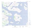
Maps showing South Amitok Island, Newfoundland and Labrador
South Amitok Island is a Island located in Newfoundland and Labrador and has an elevation of 31 meters.
- Latitude: 57° 16' 52'' North (decimal: 57.2810722)
- Longitude: 61° 48' 42'' West (decimal: -61.8115385)
- Topography Feature Category: Island
- Geographical Feature: Island
- Canadian Province/Territory: Newfoundland and Labrador
- Elevation: 31 meters
- Atlas of Canada Locator Map: South Amitok Island
- GPS Coordinate Locator Map: South Amitok Island Lat/Long