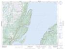
Maps showing Sop's Arm, Humber Valley, Newfoundland and Labrador
Sop's Arm is a Unincorporated area located in Humber Valley, Newfoundland and Labrador and has an elevation of 17 meters.
- Latitude: 49° 46' 25'' North (decimal: 49.7736111)
- Longitude: 56° 52' 34'' West (decimal: -56.8761111)
- Topography Feature Category: Unincorporated area
- Geographical Feature: Local Service District
- Canadian Province/Territory: Newfoundland and Labrador
- Elevation: 17 meters
- Location: Humber Valley
- Atlas of Canada Locator Map: Sop's Arm
- GPS Coordinate Locator Map: Sop's Arm Lat/Long
Sop's Arm NTS Map Sheets