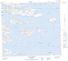
Maps showing Uigortlek Island, Newfoundland and Labrador
Uigortlek Island is a Island located in Newfoundland and Labrador and has an elevation of 52 meters.
- Latitude: 56° 24' 23'' North (decimal: 56.4063888)
- Longitude: 61° 16' 53'' West (decimal: -61.2813888)
- Topography Feature Category: Island
- Geographical Feature: Island
- Canadian Province/Territory: Newfoundland and Labrador
- Elevation: 52 meters
- Atlas of Canada Locator Map: Uigortlek Island
- GPS Coordinate Locator Map: Uigortlek Island Lat/Long