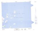
Maps showing Ukallik (Hare) Island, Newfoundland and Labrador
Ukallik (Hare) Island is a Island located in Newfoundland and Labrador and has an elevation of 5 meters.
- Latitude: 56° 12' 7'' North (decimal: 56.2019444)
- Longitude: 60° 36' 42'' West (decimal: -60.6116666)
- Topography Feature Category: Island
- Geographical Feature: Island
- Canadian Province/Territory: Newfoundland and Labrador
- Elevation: 5 meters
- Atlas of Canada Locator Map: Ukallik (Hare) Island
- GPS Coordinate Locator Map: Ukallik (Hare) Island Lat/Long
Ukallik (Hare) Island NTS Map Sheets