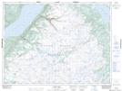
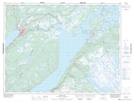
Maps showing Upper Glide Lake, Newfoundland and Labrador
Upper Glide Lake is a Lake located in Newfoundland and Labrador and has an elevation of 267 meters.
- Latitude: 48° 59' 59'' North (decimal: 48.9997216)
- Longitude: 57° 27' 55'' West (decimal: -57.4651552)
- Topography Feature Category: Lake
- Geographical Feature: Lake
- Canadian Province/Territory: Newfoundland and Labrador
- Elevation: 267 meters
- Atlas of Canada Locator Map: Upper Glide Lake
- GPS Coordinate Locator Map: Upper Glide Lake Lat/Long
Upper Glide Lake NTS Map Sheets