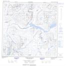
Maps showing Upper Kangalaksiorvik Lake, Newfoundland and Labrador
Upper Kangalaksiorvik Lake is a Lake located in Newfoundland and Labrador and has an elevation of 58 meters.
- Latitude: 59° 23' 13'' North (decimal: 59.3870681)
- Longitude: 64° 11' 20'' West (decimal: -64.1889668)
- Topography Feature Category: Lake
- Geographical Feature: Lake
- Canadian Province/Territory: Newfoundland and Labrador
- Elevation: 58 meters
- Atlas of Canada Locator Map: Upper Kangalaksiorvik Lake
- GPS Coordinate Locator Map: Upper Kangalaksiorvik Lake Lat/Long
Upper Kangalaksiorvik Lake NTS Map Sheets