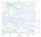
Maps showing South Channel Cairn, Newfoundland and Labrador
South Channel Cairn is a Mountain located in Newfoundland and Labrador and has an elevation of 111 meters.
- Latitude: 56° 31' 32'' North (decimal: 56.5254785)
- Longitude: 61° 39' 29'' West (decimal: -61.6580963)
- Topography Feature Category: Mountain
- Geographical Feature: Hill
- Canadian Province/Territory: Newfoundland and Labrador
- Elevation: 111 meters
- Atlas of Canada Locator Map: South Channel Cairn
- GPS Coordinate Locator Map: South Channel Cairn Lat/Long