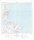
Maps showing Southeast Entrance Point, Newfoundland and Labrador
Southeast Entrance Point is a Cape located in Newfoundland and Labrador.
- Latitude: 59° 5' 40'' North (decimal: 59.0945329)
- Longitude: 63° 23' 26'' West (decimal: -63.3905182)
- Topography Feature Category: Cape
- Geographical Feature: Point
- Canadian Province/Territory: Newfoundland and Labrador
- Atlas of Canada Locator Map: Southeast Entrance Point
- GPS Coordinate Locator Map: Southeast Entrance Point Lat/Long
Southeast Entrance Point NTS Map Sheets