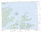
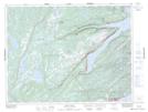
Maps showing St. Patricks, Newfoundland and Labrador
St. Patricks is a Unincorporated area located in Newfoundland and Labrador and has an elevation of 55 meters.
- Latitude: 49° 34' 32'' North (decimal: 49.5755555)
- Longitude: 55° 59' 8'' West (decimal: -55.9855555)
- Topography Feature Category: Unincorporated area
- Geographical Feature: Local Service District
- Canadian Province/Territory: Newfoundland and Labrador
- Elevation: 55 meters
- Atlas of Canada Locator Map: St. Patricks
- GPS Coordinate Locator Map: St. Patricks Lat/Long
St. Patricks NTS Map Sheets