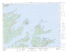
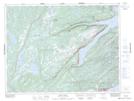
Maps showing Western Arm, Newfoundland and Labrador
Western Arm is a Bay located in Newfoundland and Labrador and has an elevation of 11 meters.
- Latitude: 49° 41' 27'' North (decimal: 49.6908333)
- Longitude: 55° 55' 35'' West (decimal: -55.9263888)
- Topography Feature Category: Bay
- Geographical Feature: Arm
- Canadian Province/Territory: Newfoundland and Labrador
- Elevation: 11 meters
- Atlas of Canada Locator Map: Western Arm
- GPS Coordinate Locator Map: Western Arm Lat/Long
Western Arm NTS Map Sheets