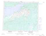
Maps showing White Bear River, Newfoundland and Labrador
White Bear River is a River located in Newfoundland and Labrador and has an elevation of 8 meters.
- Latitude: 53° 34' 51'' North (decimal: 53.5807096)
- Longitude: 57° 31' 36'' West (decimal: -57.5266965)
- Topography Feature Category: River
- Geographical Feature: River
- Canadian Province/Territory: Newfoundland and Labrador
- Elevation: 8 meters
- Atlas of Canada Locator Map: White Bear River
- GPS Coordinate Locator Map: White Bear River Lat/Long
White Bear River NTS Map Sheets