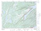
Maps showing White Hills, Newfoundland and Labrador
White Hills is a Mountain located in Newfoundland and Labrador and has an elevation of 180 meters.
- Latitude: 49° 44' 2'' North (decimal: 49.7340138)
- Longitude: 56° 4' 16'' West (decimal: -56.0711416)
- Topography Feature Category: Mountain
- Geographical Feature: Hills
- Canadian Province/Territory: Newfoundland and Labrador
- Elevation: 180 meters
- Atlas of Canada Locator Map: White Hills
- GPS Coordinate Locator Map: White Hills Lat/Long
White Hills NTS Map Sheets