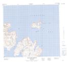
Maps showing White Point, Newfoundland and Labrador
White Point is a Cape located in Newfoundland and Labrador and has an elevation of 58 meters.
- Latitude: 57° 53' 28'' North (decimal: 57.8910607)
- Longitude: 61° 39' 50'' West (decimal: -61.6637649)
- Topography Feature Category: Cape
- Geographical Feature: Point
- Canadian Province/Territory: Newfoundland and Labrador
- Elevation: 58 meters
- Atlas of Canada Locator Map: White Point
- GPS Coordinate Locator Map: White Point Lat/Long
White Point NTS Map Sheets