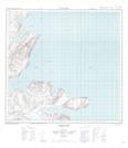
Maps showing Wilder Rocks, Newfoundland and Labrador
Wilder Rocks is a Shoal located in Newfoundland and Labrador and has an elevation of 0 meters.
- Latitude: 59° 14' 1'' North (decimal: 59.2334846)
- Longitude: 63° 20' 57'' West (decimal: -63.3491778)
- Topography Feature Category: Shoal
- Geographical Feature: Rocks
- Canadian Province/Territory: Newfoundland and Labrador
- Elevation: 0 meters
- Atlas of Canada Locator Map: Wilder Rocks
- GPS Coordinate Locator Map: Wilder Rocks Lat/Long
Wilder Rocks NTS Map Sheets