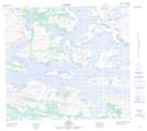
Maps showing Cape Williams, Newfoundland and Labrador
Cape Williams is a Cape located in Newfoundland and Labrador and has an elevation of 42 meters.
- Latitude: 56° 36' 43'' North (decimal: 56.6120275)
- Longitude: 61° 54' 31'' West (decimal: -61.9086163)
- Topography Feature Category: Cape
- Geographical Feature: Cape
- Canadian Province/Territory: Newfoundland and Labrador
- Elevation: 42 meters
- Atlas of Canada Locator Map: Cape Williams
- GPS Coordinate Locator Map: Cape Williams Lat/Long