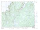
Maps showing Baie Verte, Newfoundland and Labrador
Baie Verte is a Town located in Newfoundland and Labrador and has an elevation of 34 meters.
- Latitude: 49° 54' 31'' North (decimal: 49.9087083)
- Longitude: 56° 11' 41'' West (decimal: -56.1946583)
- Topography Feature Category: Town
- Geographical Feature: Town
- Canadian Province/Territory: Newfoundland and Labrador
- Elevation: 34 meters
- Atlas of Canada Locator Map: Baie Verte
- GPS Coordinate Locator Map: Baie Verte Lat/Long
Baie Verte NTS Map Sheets