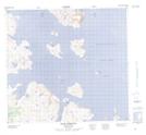
Maps showing Khikkertaujak Island, Torngat Mountains, Newfoundland and Labrador
Khikkertaujak Island is a Island located in Torngat Mountains, Newfoundland and Labrador.
- Latitude: 57° 43' 58'' North (decimal: 57.7328006)
- Longitude: 61° 57' 7'' West (decimal: -61.9519119)
- Topography Feature Category: Island
- Geographical Feature: Island
- Canadian Province/Territory: Newfoundland and Labrador
- Location: Torngat Mountains
- Atlas of Canada Locator Map: Khikkertaujak Island
- GPS Coordinate Locator Map: Khikkertaujak Island Lat/Long