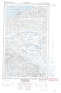
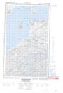
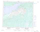
Maps showing Outer Barred Islands, Eagle River, Newfoundland and Labrador
Outer Barred Islands is a Island located in Eagle River, Newfoundland and Labrador.
- Latitude: 53° 50' 56'' North (decimal: 53.8488888)
- Longitude: 58° 59' 28'' West (decimal: -58.9911111)
- Topography Feature Category: Island
- Geographical Feature: Islands
- Canadian Province/Territory: Newfoundland and Labrador
- Location: Eagle River
- Atlas of Canada Locator Map: Outer Barred Islands
- GPS Coordinate Locator Map: Outer Barred Islands Lat/Long
Outer Barred Islands NTS Map Sheets