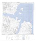
Maps showing Seven Islands Bay, Newfoundland and Labrador
Seven Islands Bay is a Bay located in Newfoundland and Labrador and has an elevation of 0 meters.
- Latitude: 59° 24' 50'' North (decimal: 59.4138442)
- Longitude: 63° 44' 59'' West (decimal: -63.7496703)
- Topography Feature Category: Bay
- Geographical Feature: Bay
- Canadian Province/Territory: Newfoundland and Labrador
- Elevation: 0 meters
- Atlas of Canada Locator Map: Seven Islands Bay
- GPS Coordinate Locator Map: Seven Islands Bay Lat/Long
Seven Islands Bay NTS Map Sheets