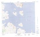
Maps showing Shark Island, Newfoundland and Labrador
Shark Island is a Island located in Newfoundland and Labrador and has an elevation of 11 meters.
- Latitude: 57° 38' 20'' North (decimal: 57.6390159)
- Longitude: 61° 40' 34'' West (decimal: -61.6760154)
- Topography Feature Category: Island
- Geographical Feature: Island
- Canadian Province/Territory: Newfoundland and Labrador
- Elevation: 11 meters
- Atlas of Canada Locator Map: Shark Island
- GPS Coordinate Locator Map: Shark Island Lat/Long