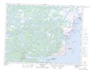
Maps showing Clotty Islands Neck, Bonavista North, Newfoundland and Labrador
Clotty Islands Neck is a Cape located in Bonavista North, Newfoundland and Labrador.
- Latitude: 49° 7' 48'' North (decimal: 49.1300000)
- Longitude: 53° 37' 43'' West (decimal: -53.6286111)
- Topography Feature Category: Cape
- Geographical Feature: Neck
- Canadian Province/Territory: Newfoundland and Labrador
- Location: Bonavista North
- Atlas of Canada Locator Map: Clotty Islands Neck
- GPS Coordinate Locator Map: Clotty Islands Neck Lat/Long
Clotty Islands Neck NTS Map Sheets