Maps showing South Bill, Bonavista North, Newfoundland and Labrador
South Bill is a Cape located in Bonavista North, Newfoundland and Labrador.
- Latitude: 49° 15' 15'' North (decimal: 49.2541666)
- Longitude: 53° 27' 58'' West (decimal: -53.4661111)
- Topography Feature Category: Cape
- Geographical Feature: Point
- Canadian Province/Territory: Newfoundland and Labrador
- Location: Bonavista North
- Atlas of Canada Locator Map: South Bill
- GPS Coordinate Locator Map: South Bill Lat/Long
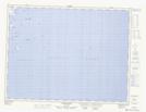
South Bill NTS Map Sheets