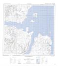
Maps showing Lone Rock, Newfoundland and Labrador
Lone Rock is a Shoal located in Newfoundland and Labrador.
- Latitude: 59° 24' 5'' North (decimal: 59.4014346)
- Longitude: 63° 44' 34'' West (decimal: -63.7427797)
- Topography Feature Category: Shoal
- Geographical Feature: Rock
- Canadian Province/Territory: Newfoundland and Labrador
- Atlas of Canada Locator Map: Lone Rock
- GPS Coordinate Locator Map: Lone Rock Lat/Long
Lone Rock NTS Map Sheets