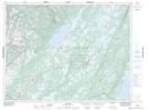
Maps showing Birchy Ridge, Newfoundland and Labrador
Birchy Ridge is a Mountain located in Newfoundland and Labrador and has an elevation of 271 meters.
- Latitude: 49° 19' 15'' North (decimal: 49.3208333)
- Longitude: 57° 5' 41'' West (decimal: -57.0947222)
- Topography Feature Category: Mountain
- Geographical Feature: Ridge
- Canadian Province/Territory: Newfoundland and Labrador
- Elevation: 271 meters
- Atlas of Canada Locator Map: Birchy Ridge
- GPS Coordinate Locator Map: Birchy Ridge Lat/Long