Maps showing Saltons Marshes, Newfoundland and Labrador
Saltons Marshes is a Low vegetation located in Newfoundland and Labrador and has an elevation of 119 meters.
- Latitude: 48° 33' 34'' North (decimal: 48.5594444)
- Longitude: 54° 1' 23'' West (decimal: -54.0230555)
- Topography Feature Category: Low vegetation
- Geographical Feature: Marshes
- Canadian Province/Territory: Newfoundland and Labrador
- Elevation: 119 meters
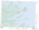
- Atlas of Canada Locator Map: Saltons Marshes
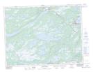
- GPS Coordinate Locator Map: Saltons Marshes Lat/Long
Saltons Marshes NTS Map Sheets