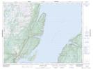
Maps showing Man O'War Point, Newfoundland and Labrador
Man O'War Point is a Cape located in Newfoundland and Labrador and has an elevation of 44 meters.
- Latitude: 49° 49' 54'' North (decimal: 49.8316666)
- Longitude: 56° 34' 3'' West (decimal: -56.5674999)
- Topography Feature Category: Cape
- Geographical Feature: Point
- Canadian Province/Territory: Newfoundland and Labrador
- Elevation: 44 meters
- Atlas of Canada Locator Map: Man O'War Point
- GPS Coordinate Locator Map: Man O'War Point Lat/Long
Man O'War Point NTS Map Sheets