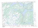
Maps showing Thorburn Lake, Newfoundland and Labrador
Thorburn Lake is a Unincorporated area located in Newfoundland and Labrador and has an elevation of 119 meters.
- Latitude: 48° 16' 3'' North (decimal: 48.2675000)
- Longitude: 54° 9' 27'' West (decimal: -54.1575000)
- Topography Feature Category: Unincorporated area
- Geographical Feature: Locality
- Canadian Province/Territory: Newfoundland and Labrador
- Elevation: 119 meters
- Atlas of Canada Locator Map: Thorburn Lake
- GPS Coordinate Locator Map: Thorburn Lake Lat/Long
Thorburn Lake NTS Map Sheets