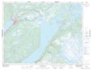
Maps showing Main Dam, Newfoundland and Labrador
Main Dam is a Unincorporated area located in Newfoundland and Labrador.
- Latitude: 49° 12' 00'' North (decimal: 49.1999999)
- Longitude: 57° 15' 57'' West (decimal: -57.2658333)
- Topography Feature Category: Unincorporated area
- Geographical Feature: Station
- Canadian Province/Territory: Newfoundland and Labrador
- GPS Coordinate Locator Map: Main Dam Lat/Long
Main Dam NTS Map Sheets