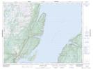
Maps showing O'Adams Ridge, Newfoundland and Labrador
O'Adams Ridge is a Mountain located in Newfoundland and Labrador and has an elevation of 200 meters.
- Latitude: 49° 48' 35'' North (decimal: 49.8097221)
- Longitude: 56° 30' 46'' West (decimal: -56.5127778)
- Topography Feature Category: Mountain
- Geographical Feature: Ridge
- Canadian Province/Territory: Newfoundland and Labrador
- Elevation: 200 meters
- Atlas of Canada Locator Map: O'Adams Ridge
- GPS Coordinate Locator Map: O'Adams Ridge Lat/Long
O'Adams Ridge NTS Map Sheets