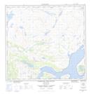
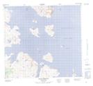
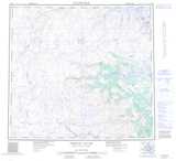
Maps showing Tessiujarsuk Cove, Newfoundland and Labrador
Tessiujarsuk Cove is a Bay located in Newfoundland and Labrador and has an elevation of 4 meters.
- Latitude: 57° 31' 1'' North (decimal: 57.5170228)
- Longitude: 61° 59' 50'' West (decimal: -61.9971752)
- Topography Feature Category: Bay
- Geographical Feature: Cove
- Canadian Province/Territory: Newfoundland and Labrador
- Elevation: 4 meters
- Atlas of Canada Locator Map: Tessiujarsuk Cove
- GPS Coordinate Locator Map: Tessiujarsuk Cove Lat/Long
Tessiujarsuk Cove NTS Map Sheets