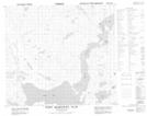
Maps showing Port Manvers Run, Newfoundland and Labrador
Port Manvers Run is a Channel located in Newfoundland and Labrador and has an elevation of 0 meters.
- Latitude: 56° 52' 58'' North (decimal: 56.8828481)
- Longitude: 61° 37' 31'' West (decimal: -61.6252746)
- Topography Feature Category: Channel
- Geographical Feature: Run
- Canadian Province/Territory: Newfoundland and Labrador
- Elevation: 0 meters
- Atlas of Canada Locator Map: Port Manvers Run
- GPS Coordinate Locator Map: Port Manvers Run Lat/Long
Port Manvers Run NTS Map Sheets