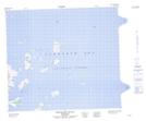
Maps showing Wingiayuk Island (Lopsided), Torngat, Newfoundland and Labrador
Wingiayuk Island (Lopsided) is a Island located in Torngat, Newfoundland and Labrador.
- Latitude: 56° 4' 00'' North (decimal: 56.0666666)
- Longitude: 60° 55' 57'' West (decimal: -60.9325000)
- Topography Feature Category: Island
- Geographical Feature: Island
- Canadian Province/Territory: Newfoundland and Labrador
- Location: Torngat
- GPS Coordinate Locator Map: Wingiayuk Island (Lopsided) Lat/Long
Wingiayuk Island (Lopsided) NTS Map Sheets