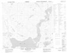
Maps showing Ram Tickle, Newfoundland and Labrador
Ram Tickle is a Channel located in Newfoundland and Labrador and has an elevation of 14 meters.
- Latitude: 56° 49' 52'' North (decimal: 56.8312044)
- Longitude: 61° 11' 54'' West (decimal: -61.1983163)
- Topography Feature Category: Channel
- Geographical Feature: Tickle
- Canadian Province/Territory: Newfoundland and Labrador
- Elevation: 14 meters
- Atlas of Canada Locator Map: Ram Tickle
- GPS Coordinate Locator Map: Ram Tickle Lat/Long
Ram Tickle NTS Map Sheets