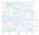
Maps showing Upper Trout Brook, Newfoundland and Labrador
Upper Trout Brook is a River located in Newfoundland and Labrador.
- Latitude: 56° 43' 0'' North (decimal: 56.7167829)
- Longitude: 61° 22' 57'' West (decimal: -61.3824093)
- Topography Feature Category: River
- Geographical Feature: Brook
- Canadian Province/Territory: Newfoundland and Labrador
- Atlas of Canada Locator Map: Upper Trout Brook
- GPS Coordinate Locator Map: Upper Trout Brook Lat/Long