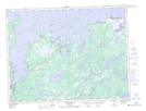
Maps showing Philips Marsh, Fogo, Newfoundland and Labrador
Philips Marsh is a Low vegetation located in Fogo, Newfoundland and Labrador and has an elevation of 60 meters.
- Latitude: 49° 22' 37'' North (decimal: 49.3769444)
- Longitude: 53° 59' 37'' West (decimal: -53.9936111)
- Topography Feature Category: Low vegetation
- Geographical Feature: Marsh
- Canadian Province/Territory: Newfoundland and Labrador
- Elevation: 60 meters
- Location: Fogo
- Atlas of Canada Locator Map: Philips Marsh
- GPS Coordinate Locator Map: Philips Marsh Lat/Long
Philips Marsh NTS Map Sheets