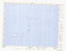
Maps showing Rods Rock, Fogo, Newfoundland and Labrador
Rods Rock is a Shoal located in Fogo, Newfoundland and Labrador and has an elevation of 0 meters.
- Latitude: 49° 32' 45'' North (decimal: 49.5458333)
- Longitude: 53° 51' 59'' West (decimal: -53.8663888)
- Topography Feature Category: Shoal
- Geographical Feature: Rock
- Canadian Province/Territory: Newfoundland and Labrador
- Elevation: 0 meters
- Location: Fogo
- Atlas of Canada Locator Map: Rods Rock
- GPS Coordinate Locator Map: Rods Rock Lat/Long
Rods Rock NTS Map Sheets