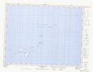
Maps showing Scrub Island, Fogo, Newfoundland and Labrador
Scrub Island is a Island located in Fogo, Newfoundland and Labrador.
- Latitude: 49° 30' 0'' North (decimal: 49.5000000)
- Longitude: 53° 50' 57'' West (decimal: -53.8491666)
- Topography Feature Category: Island
- Geographical Feature: Island
- Canadian Province/Territory: Newfoundland and Labrador
- Location: Fogo
- Atlas of Canada Locator Map: Scrub Island
- GPS Coordinate Locator Map: Scrub Island Lat/Long
Scrub Island NTS Map Sheets