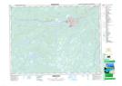
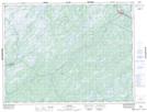
Maps showing Tom Joe Brook, Newfoundland and Labrador
Tom Joe Brook is a River located in Newfoundland and Labrador.
- Latitude: 46° 56' 46'' North (decimal: 46.9460999)
- Longitude: 55° 55' 51'' West (decimal: -55.9307999)
- Topography Feature Category: River
- Geographical Feature: Brook
- Canadian Province/Territory: Newfoundland and Labrador
- Atlas of Canada Locator Map: Tom Joe Brook
- GPS Coordinate Locator Map: Tom Joe Brook Lat/Long
Tom Joe Brook NTS Map Sheets