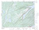
Maps showing Rattling Brook, Newfoundland and Labrador
Rattling Brook is a Unincorporated area located in Newfoundland and Labrador and has an elevation of 86 meters.
- Latitude: 49° 37' 35'' North (decimal: 49.6263888)
- Longitude: 56° 10' 5'' West (decimal: -56.1680555)
- Topography Feature Category: Unincorporated area
- Geographical Feature: Local Service District
- Canadian Province/Territory: Newfoundland and Labrador
- Elevation: 86 meters
- Atlas of Canada Locator Map: Rattling Brook
- GPS Coordinate Locator Map: Rattling Brook Lat/Long
Rattling Brook NTS Map Sheets