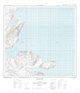
Maps showing Razorback Harbour, Newfoundland and Labrador
Razorback Harbour is a Bay located in Newfoundland and Labrador and has an elevation of 9 meters.
- Latitude: 59° 11' 46'' North (decimal: 59.1959890)
- Longitude: 63° 26' 52'' West (decimal: -63.4478677)
- Topography Feature Category: Bay
- Geographical Feature: Harbour
- Canadian Province/Territory: Newfoundland and Labrador
- Elevation: 9 meters
- Atlas of Canada Locator Map: Razorback Harbour
- GPS Coordinate Locator Map: Razorback Harbour Lat/Long
Razorback Harbour NTS Map Sheets